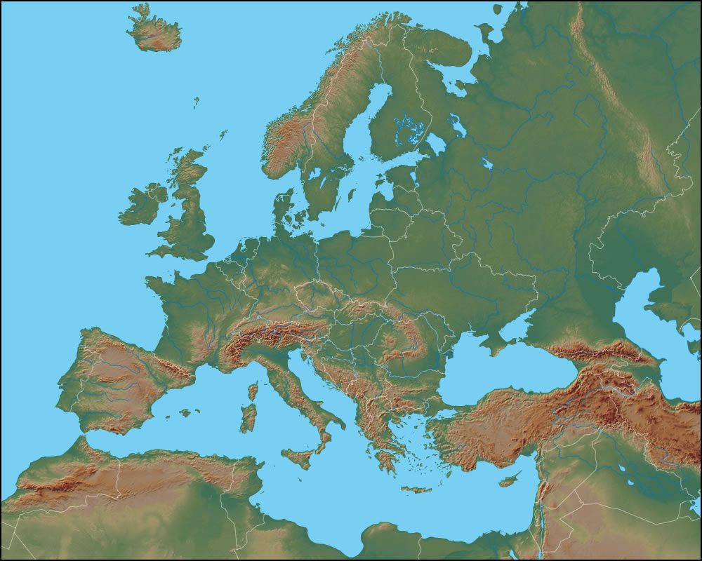
What Is A Physical Map

A physical map is a type of map that represents the natural features of an area, such as mountains, rivers, lakes, and forests. It is a two-dimensional representation of the Earth’s surface, showing the physical characteristics of a particular region or location. Physical maps are also known as topographic maps or relief maps.
Physical maps typically include a range of features, such as:
- Elevation: The height of the land above sea level, often represented by contour lines, which are imaginary lines that connect points of equal elevation.
- Water bodies: Rivers, lakes, oceans, and other bodies of water are typically represented in blue.
- Landforms: Mountains, hills, valleys, and other natural features are shown in various shades of brown, green, or gray.
- Vegetation: Forests, grasslands, and other types of vegetation are often represented by different colors or symbols.
- Climate zones: Some physical maps may include climate zones, such as deserts, tropical regions, or polar areas.
Physical maps can be created using a variety of techniques, including:
- Topographic surveys: These involve measuring the elevation and shape of the land using instruments such as theodolites and GPS.
- Aerial photography: Photographs taken from aircraft or satellites can be used to create detailed maps of the Earth’s surface.
- Satellite imagery: Satellite images can provide high-resolution data on the Earth’s surface, including features such as vegetation, water bodies, and landforms.
- GIS (Geographic Information System) technology: This involves using computer software to analyze and display geospatial data, such as elevation, land use, and climate.
Physical maps have a range of applications, including:
- Navigation: Physical maps can be used to plan routes, identify landmarks, and navigate through unfamiliar territory.
- Conservation: By showing the location and extent of natural features, physical maps can help conservation efforts, such as protecting endangered species or preserving ecosystems.
- Urban planning: Physical maps can be used to plan urban development, such as identifying areas suitable for construction or infrastructure projects.
- Emergency response: Physical maps can help emergency responders, such as firefighters or search and rescue teams, to navigate through unfamiliar terrain and respond to emergencies.
Some of the benefits of physical maps include:
- Visualization: Physical maps provide a visual representation of the Earth’s surface, making it easier to understand complex spatial relationships.
- Context: Physical maps can provide context for other types of data, such as demographic or economic information.
- Accuracy: Physical maps can be highly accurate, especially when created using advanced technologies such as GIS or satellite imagery.
- Accessibility: Physical maps can be used by people with limited technical expertise, making them a useful tool for a wide range of applications.
In addition to their practical applications, physical maps can also be used to create stunning visualizations of the Earth’s surface. For example, a physical map of the Grand Canyon might show the deep valleys, steep cliffs, and winding rivers that make up this iconic landscape.
- Gather data on the area to be mapped, such as elevation, land use, and climate.
- Use a GIS or mapping software to analyze and display the data.
- Choose a suitable scale and projection for the map, depending on the intended use and audience.
- Add symbols, colors, and other visual elements to represent different features and themes.
- Test and refine the map to ensure it is accurate and easy to use.
Overall, physical maps are a powerful tool for understanding and interacting with the natural world. By providing a visual representation of the Earth’s surface, physical maps can help us to better appreciate the complexity and beauty of our planet, and to make more informed decisions about how to use and protect it.
What is the difference between a physical map and a political map?
+A physical map shows the natural features of an area, such as mountains, rivers, and forests, while a political map shows the boundaries and features of human-made entities, such as countries, cities, and borders.
How are physical maps used in conservation efforts?
+Physical maps can be used to identify and protect sensitive ecosystems, such as wetlands or coral reefs, and to plan conservation efforts, such as habitat restoration or species reintroduction.
What is the advantage of using GIS technology to create physical maps?
+GIS technology allows for the creation of highly accurate and detailed maps, and can be used to analyze and display large datasets, making it a powerful tool for a wide range of applications, from conservation to urban planning.


